I am an Associate Professor and long-standing core faculty member in the MS GIS Administration
program for over a decade at the University of West Florida.
I hold a BA in Economics with a minor in Computer Science and an MS in Management Information Systems from the University of Central Florida, and earned my PhD in Geography from Florida State University.
My research advances computational time geography and spatial decision science, examining how environmental change, regulatory systems, and infrastructure reshape spatial access, visibility, and risk — particularly in coastal systems. My work integrates GIScience, probabilistic modeling (including Bayesian networks), Python-based workflows, and machine learning to build uncertainty-aware decision models for environmental risk and infrastructure planning.
I also maintain applied programs in hazard mapping, spatial criminology, and legal geography, leveraging GeoAI, participatory mapping, and advanced viewshed modeling to communicate complex spatial trade-offs to policy and public audiences.
Prior to academia, I served in the military reserves and worked in systems engineering, web development, and GIS application development across private and public organizations.
Florida Sea Grant Project (2024)
360 Imagery Mapping Project
UWF MS in GIS Admin Graduates
Spatial Access, Territory & Legal Geography
Time geographic constraint systems, territorial access, legal geographies of place, and how regulatory and environmental change reshapes opportunity across landscapes
Martin, V., Morgan, J. D., & Venable, K. B. (2025). Mapping illegal logging using GeoAI. In New Research in Crime Modeling and Mapping Using Geospatial Technologies. Springer.
Morgan, J. D., Douthat, T., & Lin, L. H. (2023). On the geographic balance of risk and amenity: changes in evacuation zones and their ripples in housing prices in Pinellas County, FL. Papers in Applied Geography, 9(1), 49–69.
Morgan, J.D., Bradbury, M., and Hart, T. (2022). GIS&T in Criminal Justice and Law Enforcement. The Geographic Information Science & Technology Body of Knowledge (1st Quarter 2022 Edition), John P. Wilson (ed.). DOI: 10.22224/gistbok/2022.1.4/li>
Morgan, J. D., & Evans, J. (2022). Participatory Mapping of Territoriality Across Florida’s Beaches. Springer Nature.
Morgan, J. D., & Steinberg, P. E. (2012). Testing the usability of time-geographic maps for crime mapping. In Crime Modeling and Mapping Using Geospatial Technologies (pp. 339–366). Springer.
Morgan, J. D. (2009). A visual time geographic approach to crime event profiling. Crime Mapping: A Journal of Research and Practice, 1(2), 8–39.
Conference Presentations & Invited Talks
Morgan, J. D. (2025, August). Participatory mapping to validate transboundary viewshed analysis along hurricane-prone shorelines. Paper presented at the 32nd International Cartographic Conference, Vancouver, Canada.
Morgan, J. D. (2019). Panel speaker: Geographic and historical perspectives on redistricting. The Geography of Redistricting. Harvard Center for Geographic Analysis, Cambridge, MA.
Morgan, J. D. (2019). Panel speaker/hackathon participant: Austin Gerrymandering Workshop, a regional site for the Geometry of Redistricting workshop cycle. Austin, TX.
Morgan, J. D., & Evans, J. (2022). Mapping territoriality and legal geographies across Florida's beaches. Association of American Geographers (AAG) Virtual Meeting.
Morgan, J. D., Evans, J., Honeycutt, N., Woodruff, M. M., & Barrett, E. A. (2020). Mapping beach territoriality. North American Cartographic Information Society (NACIS) Virtual Meeting.
Morgan, J. D., & Evans, J. (2020). Flip flop territoriality: A participatory exploration of property rights tension across Florida's beaches. Association of American Geographers (AAG) [canceled/rescheduled due to pandemic].
Morgan, J. D. (2016). Mapping property rights tension for ecosystem services within coastal communities. Association of American Geographers (AAG), San Francisco, CA.
Morgan, J. D. (2015). A Bayesian network approach to exploring coastal home values given hurricane evacuation zone change and the influence of coastal amenities. Southeast Division of the Association of American Geographers (SEDAAG), Pensacola, FL.
Morgan, J. D. (2015). A Bayesian network approach to exploring coastal home values given hurricane evacuation zone change and the influence of coastal amenities. Seven Hills Regional User Group for GIS (SHRUG), Tallahassee, FL.
Morgan, J. D. (2010). Testing the usability of time-geographic maps. Extended Abstracts, GIScience 2010, Zurich. *Best Poster Award
Related Media
Public Beach Access
Environmental Hazards & Resilience
Coastal change, infrastructure vulnerability, and community resilience under climate and hazard stress
Smith, T., & Morgan, J. D. (2025). Shifting horizons: Viewshed impacts from shoreline transformation and sea level rise. AGU25.
Morgan, J. D. (2025). Visualizing access and land use change in hurricane-affected landscapes through web cartography. Abstracts of the ICA, 10, 202.
Wells, J., Morgan, J. D., Crow, M. S., & Buker, N. H. (2025). A multi-faceted approach to analyzing historical police logs: A research note. Policing and Society, 35(5), 712–721.
Core, M. L., Fisher, E., Morgan, J. D., Ramachandran, B., & Vakiti, S. (2022). Lights-out after Hurricane Michael: A spatially informed Bayesian network analysis of power outages. Southeastern Geographer, 62(2), 128–146.
Austin, A., Morgan, J. D., Snider, D., & Schwartz, M. (2021). Design and development of a web mapping prototype for participatory water quality mapping. Open Water Journal, 7(1), 2.
Alibašić, H., & Morgan, J. D. (2020). Coastal climate readiness and preparedness: Comparative review of the state of Florida and Cuba. In Perception, Design and Ecology of the Built Environment: A Focus on the Global South. Springer.
Douthat, T., Morgan, J. D., Alibašić, H., & Grant, A. (2019). Passive building characteristics, and summertime residential energy use: A spatial analysis of energy efficiency in Gainesville, FL. Building and Environment, 169, 106542.
Conference Presentations & Invited Talks
Valentine, S., Duval, D., Collum, V., & Morgan, J. D. (2025, April). Changing shorelines: How changing coastal views can inform land use decisions for communities impacted by hurricanes. National Hurricane Conference, Mitigation Workshop, New Orleans, LA.
Morgan, J. D. (2024). Panel speaker: Santa Rosa County sea level rise vulnerability assessment. Coastal Alabama Geospatial Data Users Group, University of South Alabama.
Tooher-Thompson, E., Jo, B., Bloechle, A., & Morgan, J. D. (2023). Toward a more resilient Florida: A case study in coastal vulnerability modeling for better informed decision making. National Hurricane Conference, Orlando, FL.
Tooher-Thompson, E., Jo, B., Bloechle, A., & Morgan, J. D. (2023). SHRUG GIS Workshop, Tallahassee, FL.
Core, M., Martin, V., & Morgan, J. D. (2022). Grid-based analysis for high-resolution population data, social vulnerability index and nighttime lights for Tallahassee, FL. National Hurricane Conference, Orlando, FL.
Linzy, T., & Morgan, J. D. (2022). Using land use and land cover change data to observe trends in decreased water quality in Upper Escambia Bay and Blackwater Bay caused by increased development. Association of American Geographers (AAG) Virtual Meeting.
Morgan, J. D. (2020). Panel speaker: Flood vulnerability presentations. Santa Rosa County Public Meeting.
Related Media
Web Prototype: Hurricane Impacts on Homeowners Insurance
Spatial Decision Science
Bayesian networks, uncertainty-aware GIS, and decision-support modeling
Morgan, J. (2023). Spatial joins. In The Geographic Information Science & Technology Body of Knowledge (1st Quarter 2023 ed.). UCGIS.
Morgan, J. D., Douthat, T., & Lin, L. H. (2023). On the geographic balance of risk and amenity: Changes in evacuation zones and their ripples in housing prices in Pinellas County, FL. Papers in Applied Geography, 9(1), 49–69.
Core, M. L., Fisher, E., Morgan, J. D., Ramachandran, B., & Vakiti, S. (2022). Lights-out after Hurricane Michael: A spatially informed Bayesian network analysis of power outages. Southeastern Geographer, 62(2), 128–146.
Morgan, J. D., & Evans, J. (2018). Aggregation of spatial entities and legislative redistricting. The Geographic Information Science & Technology Body of Knowledge (Q3 2018). UCGIS.
Morgan, J. D., Hutchins, M. W., Fox, J., & Rogers, K. R. (2012). A methodological framework focused on integrating GIS and BBN data for probabilistic map algebra analysis. In Extended Abstracts Volume, 7th International Conference on Geographic Information Science.
Conference Presentations & Invited Talks
Morgan, J. D., Hutchins, M. W., Fox, J. F., & Rogers, K. L. (2012). A methodological framework focused on integrating GIS and BBN data for probabilistic map algebra analysis. Extended Abstracts, GIScience 2012, Columbus, OH.
Douthat, T., & Morgan, J. D. (2018). Urban form and residential housing efficiency: Creating a parametric and a causal model of building. Southern Political Science Association (SPSA), New Orleans, LA.
Mullins, J., & Morgan, J. D. (2019). Harmonizing the tabular present with its spatial future. URISA GIS-Pro, New Orleans, LA.
Sabillion, D., & Morgan, J. D. (2019). A time-geographic study of tourist travel delay as a result of traffic crashes in Central Florida. URISA GIS-Pro, New Orleans, LA.
Related Media
Bayesian Spatial Decision Modeling from my time at NEMAC
Remote Sensing, GeoAI & Cartography
Satellite imagery datasets, deep learning pipelines, wildfire and illegal logging detection, and geovisualization of complex spatial data
Martin, V., Morgan, J. D., & Venable, K. B. (2025). Mapping illegal logging using GeoAI. In New Research in Crime Modeling and Mapping Using Geospatial Technologies. Springer.
Martin, V., Venable, K. B., & Morgan, D. (2025). A Sentinel-2 benchmark and deep-learning study for wildfire damage mapping. Proceedings of the 8th ACM SIGSPATIAL International Workshop on AI for Geographic Knowledge Discovery.
Martin, V., Venable, K. B., & Morgan, D. (2025). Development and application of a Sentinel-2 satellite imagery dataset for deep-learning driven forest wildfire detection. SN Computer Science, 6(8), 921.
Martin, V., Morgan, J. D., & Venable, K. B. (2024). Python-based GeoImagery dataset development for deep learning-driven forest wildfire detection. Proceedings of the 23rd Python in Science Conference, 23.
Strode, G., Mesev, V., Bleisch, S., Ziewitz, K., Reed, F., & Morgan, J. D. (2020). Exploratory bivariate and multivariate geovisualizations of a social vulnerability index. Cartographic Perspectives, 5–23.
Strode, G., Morgan, J. D., Thornton, B., Mesev, V., Rau, E., Shortes, S., & Johnson, N. (2019). Operationalizing Trumbo's principles of bivariate choropleth map design. Cartographic Perspectives, 5–24.
Conference Presentations & Invited Talks
Martin, V., Venable, K. B., & Morgan, J. D. (2025). A Sentinel-2 benchmark and deep-learning study for wildfire damage mapping [Experiment]. 33rd ACM SIGSPATIAL International Conference on Advances in Geographic Information Systems (SIGSPATIAL 2025), Minneapolis, MN.
Martin, V., Morgan, J. D., & Venable, K. B. (2025). Automated forest wildfire detection through satellite imagery and deep learning. Association of American Geographers (AAG) 2025 Annual Meeting, Virtual.
Morgan, J. D. (2025). Teaching scripting in GIS. GIS Association of Alabama — Coastal Geospatial Data Group, Baldwin Preparatory Academy. [Invited Talk]
Martin, V., Morgan, J. D., & Venable, K. B. (2024). Python-based GeoImagery dataset development for deep learning-driven forest wildfire detection. SciPy 2024, Virtual Poster Presentation.
Morgan, J. D. (2017). Mapping perceptions of safety in city parks. North American Cartographic Information Society (NACIS), Montreal, Canada.
Morgan, J. D. (2018). Panel speaker/ideas for integrating budget-friendly GIS hardware and software options. GIS Association of Alabama Conference, Orange Beach, AL. [Invited Talk]
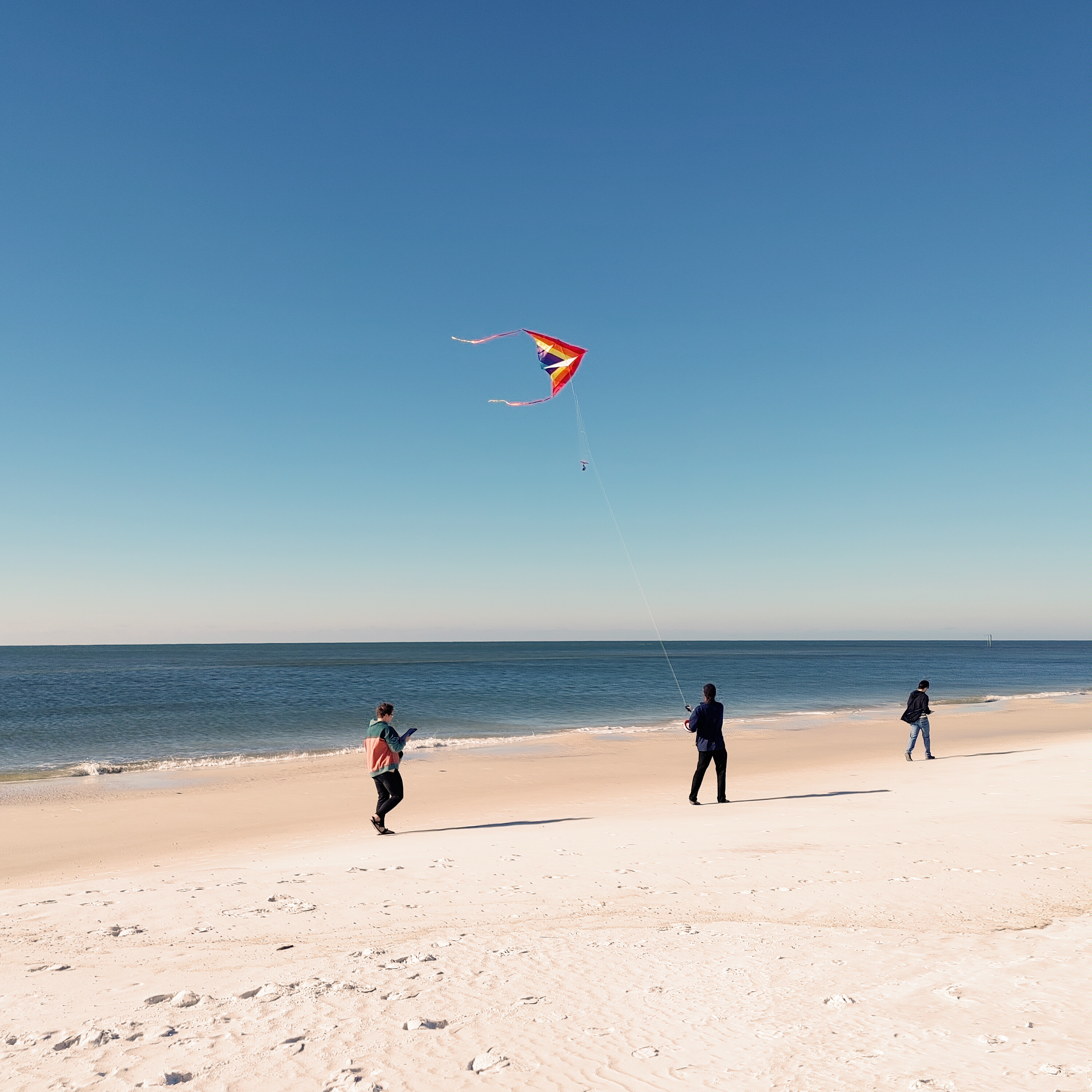 Florida Sea Grant Project (2024)
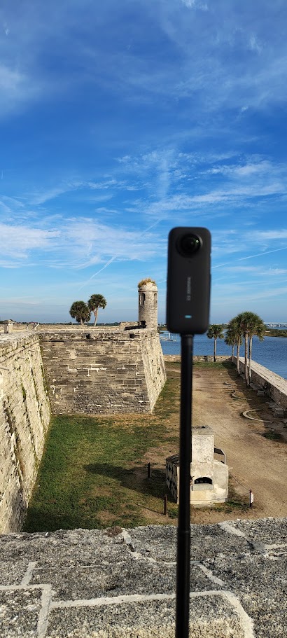 360 Imagery Mapping Project
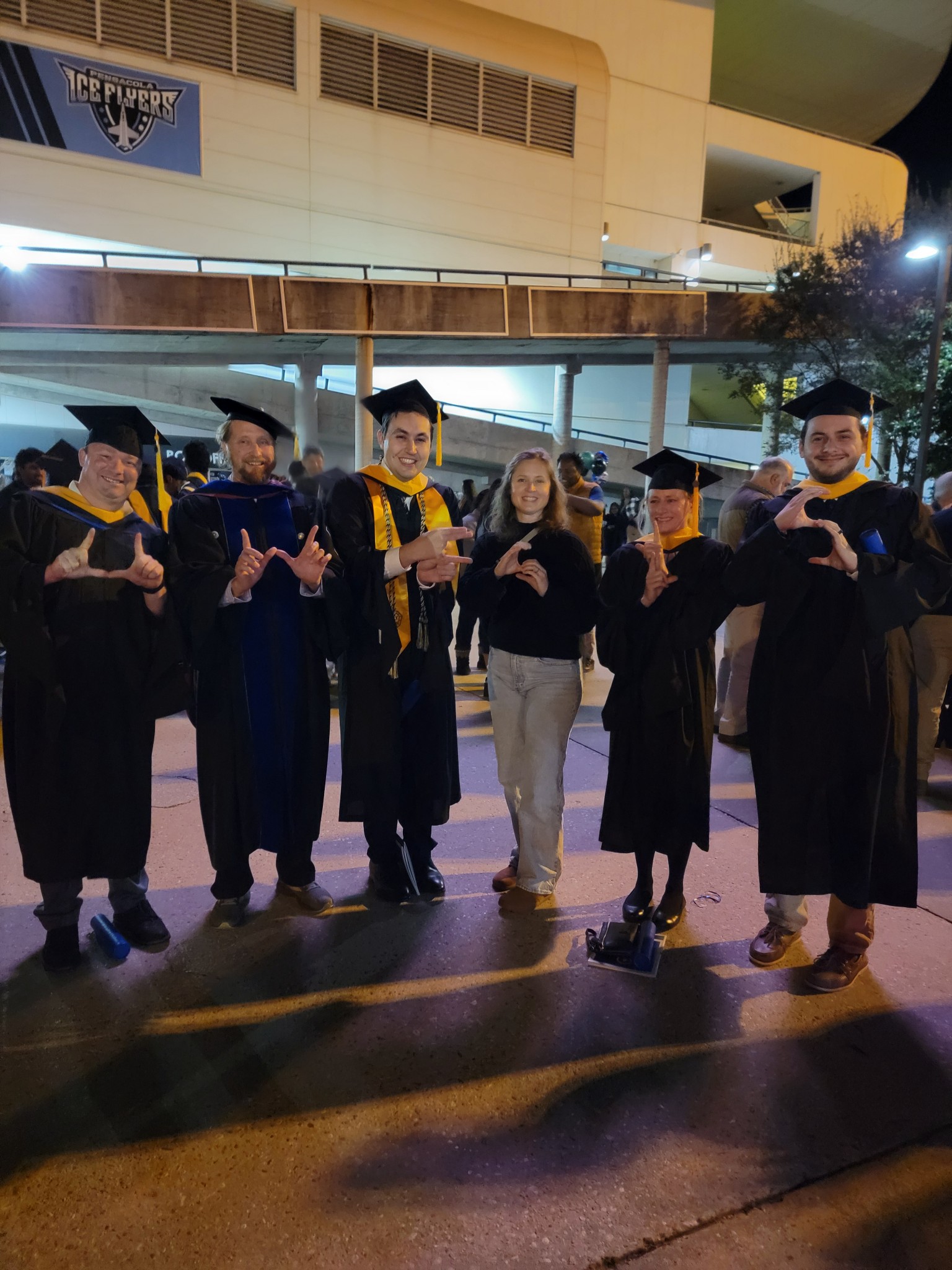 UWF MS in GIS Admin Graduates