Web map I developed for a cartography class I was teaching: Click on the events tab on the left to browse via map through historical events.
In the context of cartography, mobility-related challenges in crime mapping arise from the complexities of accurately representing dynamic spatial and temporal patterns of crime.
Morgan, J.D., Bradbury, M., and Hart, T. (2022).
GIS&T in Criminal Justice and Law Enforcement.
The Geographic Information Science & Technology Body of Knowledge (1st Quarter 2022 Edition),
John P. Wilson (ed.). DOI: 10.22224/gistbok/2022.1.4(link is external)
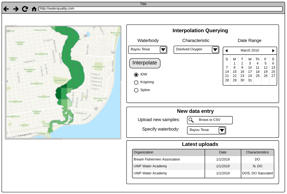
My dissertation work which tested Thorsten Hägerstrand's time geography and its applicability to crime mapping
Using satellite imagery mapping to detect illegal activities:
Martin, V., Venable, K. B., & Morgan, D. (2025). Mapping Illegal Logging Using GeoAI. In New Research in Crime Modeling and Mapping Using Geospatial Technologies. Springer Nature
By combining spatial data with analytical tools, GIS provides comprehensive insights that help in making informed decisions for hazard management and land use planning.
Hurricane impacts and land use
Morgan, J. D., Douthat, T., & Lin, L. H. (2023).
On the geographic balance of risk and amenity:
changes in evacuation zones and their ripples in housing prices in Pinellas County, FL. Papers in Applied Geography, 9(1), 49-69.
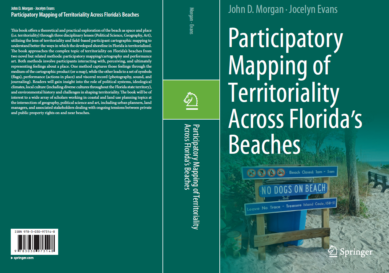
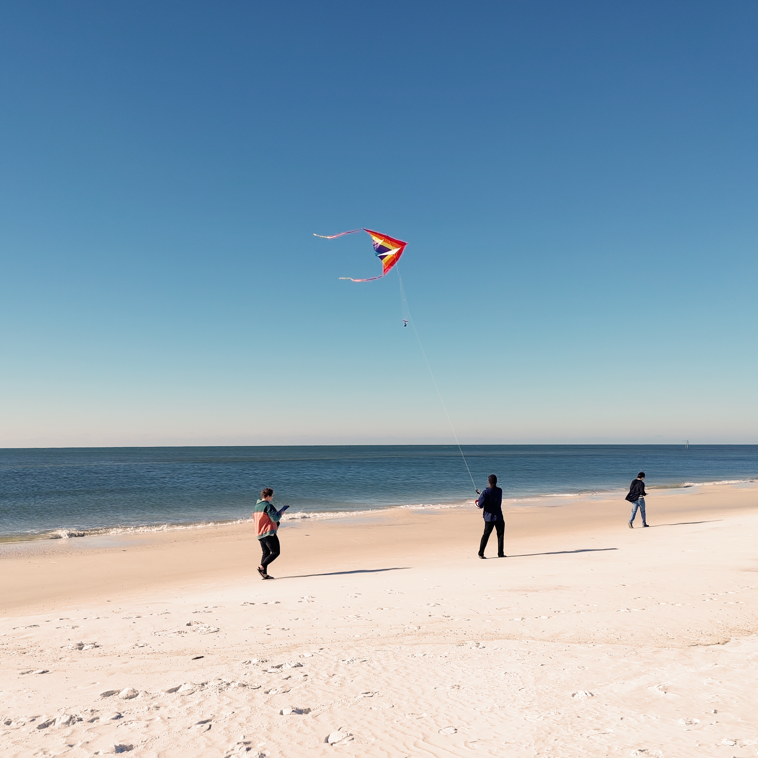
Morgan, J.D. & Evans, J. (2022). Participatory Mapping of Territoriality Across Florida's Beaches 1st ed. 2022 Edition. Springer
Presentation at North American Cartographic Information Society (2020):
John D. Morgan, Ph.D., GISP
I am an associate professor teaching primarly within the MS GIS Admin program
at the University of West Florida.
My work in academia spans geographic information systems (GIS), urban planning, environmental studies, crime mapping, and cartographic visualization,
with particular emphasis on participatory mapping and spatial analysis applications.
Growing up in tourist town economy motivated me to forge my own path, leading me to serve in the military (reserves)—an experience that
instilled discipline, a strong work ethic, and helped fund my Bachelor’s in Economics (with a Computer Science minor) at UCF. I began
my career as a computer applications programmer during the
dot-com boom
and later earned an M.S. in Management Information Systems.
While managing IT operations for Florida State University's International Programs, I pursued and completed a Ph.D. in Geography with
an eye towards eventually moving into academia.
Following my doctoral studies, I joined the National Environmental Modeling and Analysis
Center (NEMAC) at UNC Asheville as a Senior Research Scientist and Applied Software Designer,
where I developed full-stack Web GIS solutions for clients such as the USDA Forest Service.